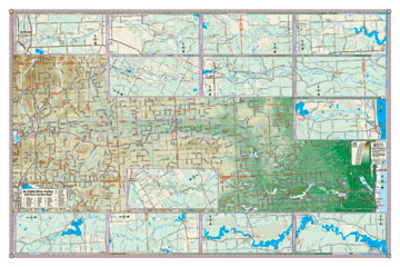
Au Sable River Valley
with River Corridor Maps
General Reference Map
Depicting Land in Physical Relief
The legendary Au Sable river comes to life on this full featured map of the entire stretch of the river. Detailed physical relief allows one to see the expanse of the watershed and follow each twist and turn of the watercourse. Breakout maps show the river corridor in detail with all the public accesses, boat ramps, campgrounds, etc. Break-out maps depict public land ownership along the river. A perfect map for the paddler or angler. A folding pocket map version of this map is also available to take with you on your paddling adventure. North Branch and South Branch break-out maps are also included. Coverage: Grayling to Oscoda (Lake Huron).
Giclee print on acid-free premium coated stock.
Item# – ASV36– 36 " x 24"
36” x
24” — $29.95 (Print)
36” x 24 ” — $59.95 (Laminated
Print)
Northeast Michigan
General Reference Map
Depicting Land in Physical Relief
A fully featured reference map that includes a full complement of topographic features for both the general traveler and recreational tourist. This map includes an alphabetical index of road and village names coded to a grid for easy location. The colorful relief background creates a particularly striking image for interior design and provides opportunities for study of geology and hydrology. Coverage: Tawas City to Mackinaw City, I-75/127 to Lake Huron.
Giclee print on acid-free premium coated stock.
Item# – NEPR27 – 27 " x
36"
Item# – NEPR32 – 32 " x 42"
Item# – NEPR42 – 42" x 56"
27” x
36” — $29.95 (Print)
27” x 36” — $59.95 (Laminated
Print)
32” x
42” — $50.00 (Print)
32” x 42 ” — $95.00 (Laminated
Print)
42” x
56” — $81.00 (Print)
42” x 56” — $156.00 (Laminated
Print)
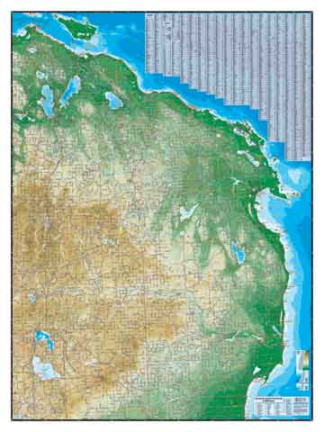
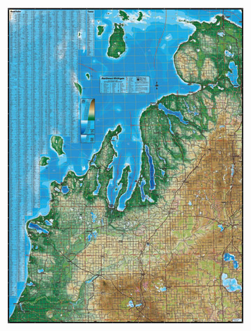
Northwest Michigan
General Reference Map
Depicting Public and Private Lands
A fully featured reference map that includes a full complement of topographic features for both the general traveler and recreational tourist. This map includes an alphabetical index of road and village names coded to a grid for easy location. Public and open lands are color coded for planning outdoor excursions. Coverage: Manistee to Mackinac Straits, I-75 to Lake Michigan (includes the upper Lake Michigan islands).
Giclee print on acid-free premium coated stock.
Item# – NWPL27 – 27 " x
36"
Item# – NWPL32 – 32 " x 42"
Item# – NWPL42 – 42" x 56"
27” x
36” — $29.95 (Print)
27” x 36” — $59.95 (Laminated
Print)
32” x
42” — $50.00 (Print)
32” x 42 ” — $95.00 (Laminated
Print)
42” x
56” — $81.00 (Print)
42” x 56” — $156.00 (Laminated
Print)
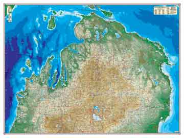
Northwest Michigan
General Reference Map
Depicting Land in Physical Relief
A fully featured reference map that includes a full complement of topographic features for both the general traveler and recreational tourist. This map includes an alphabetical index of road and village names coded to a grid for easy location. The colorful relief background creates a particularly striking image for interior design and provides opportunities for study of geology and hydrology. Coverage: Manistee to Mackinac Straits, I-75 to Lake Michigan (includes the upper Lake Michigan islands).
Giclee print on acid-free premium coated stock.
Item# – NWPR27 – 27 " x
36"
Item# – NWPR32 – 32 " x 42"
Item# – NWPR42 – 42" x 56"
27” x
36” — $29.95 (Print)
27” x 36” — $59.95 (Laminated
Print)
32” x
42” — $50.00 (Print)
32” x 42 ” — $95.00 (Laminated
Print)
42” x
56” — $81.00 (Print)
42” x 56” — $156.00 (Laminated
Print)
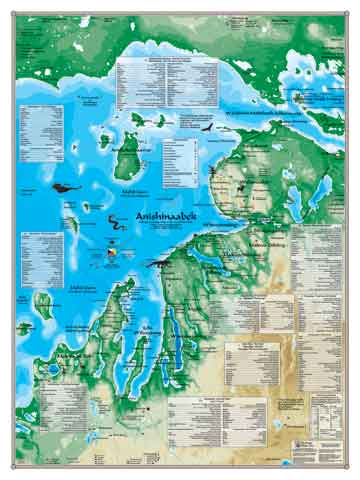
Northwest Michigan Anishinaabek Heritage Map
This map depicts the historic and cultural sites of the Three Fires People—the Ojibwe, Odawa and Potawatomi tribes—collectively known as the Anishnabe nation. Camps, villages, burial grounds, council grounds battle sites, gardens, pathways, waterways,, portages, and more are displayed, along with the areas of influence by prominent Ogema and Ogemakwe. Original site names are accompanied by translations and a pronunciation key. This title is the culmination of years of research by linguist Elizabeth Lee Evans in conjunction with native American scholars and tribal members.
Giclee print on acid-free premium coated stock.
Item# – ANNW27– 27 " x
36"
Item# – ANNW32 – 32" x 42"
Item# – ANNW42 – 42" x 56"
27” x
36” — $29.95 (Print)
27” x 36 ” — $59.95 (Laminated
Print)
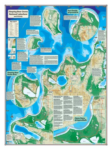
Sleeping Bear National Lakeshore
This is the map to enjoy your memories of a Sleeping
Bear vacation or to plan your next Sleeping Bear adventure. The entire
park, including the Manitou Islands is depicted in physical relief and
with all the trails, interesting features and cultural sites. A folding
pocket version of this map is also available to guide you in the field.
Giclee print on acid-free premium coated stock.
Item# – SBPR18 – 18 " x
24"
Item# – SBPR27 – 27 " x 36 "
18” x
24” — $19.95 (Print)
18” x 24” — $31.95 (Laminated
Print)
27” x
36” — $29.95 (Print)
27” x 36” — $59.95 (Laminated
Print)
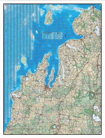
Tip of the Mitt, Michigan
General Reference Map
Depicting Land in Physical Relief
Thumbnail images can't convey the beauty and detail of our wall maps—and that's especially true for this striking map. The contrast of the varying blues with the earth tones of the interior blurs the distinction between map and art. The two larger sizes of the map include all the features of our standard cartography. Some features are withheld in the 36" x 27" size to improve readibility. Coverage: Manistee in southwest, Tawas City in southeast, Mackinac Straits in the north.
Giclee print on acid-free premium coated stock.
Item# – TMPR27 – 36 " x
27"
Item# – TMPR32 – 42 " x 32 "
Item# – TMPR42 – 56 " x 42 "
36” x
27” — $29.95 (Print)
36” x 27” — $59.95 (Laminated
Print)
42” x
32” — $50.00 (Print)
42” x 32” — $95.00 (Laminated
Print)
56” x
42” — $81.00 (Print)
56” x 42” — $156.00 (Laminated
Print)
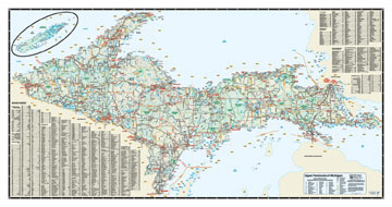
Upper Peninsula of Michigan
General Reference Map
Depicting Public and Private Lands
A fully featured reference map that includes a full complement of topographic features for both the general traveler and recreational tourist. This map includes an alphabetical index of road and village names coded to a grid for easy location. Public and open lands are color coded for planning outdoor excursions. Coverage: Entire Upper Peninsul and Isle Royale.
Giclee print on acid-free premium coated stock.
Item# – UPPL45– 45 " x 24"
45” x
24” — $35.95 (Print)
45” x 24” — $67.95 (Laminated
Print)