| Title: |
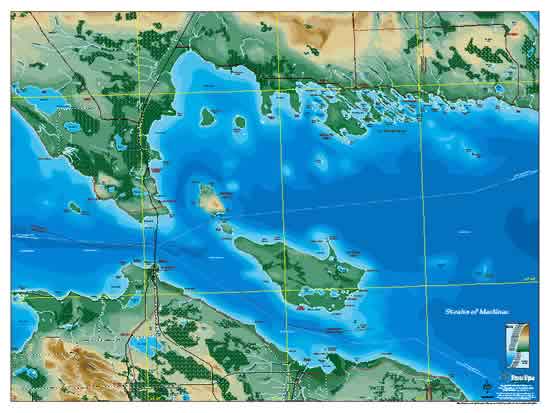
Mackinac Straits Poster |
| Publication Date/Status: |
1999 - In Print ($7.95 srp, $11.95 shrink-wrapped) |
| Size (in Inches) |
24 x 18 |
| Coverage Area: |
Mackinac Straits (the confluence of Lakes Michigan and Huron) from Waugoshance Pt. on the west to the Spectacle Reef Light on the east, including Cheboygan, Bois Blanc Island, Mackinaw City, Mackinac Island, St. Ignace and the Les Cheneaux Islands. |
| Description: |
A 4-color detailed map depicting the historic Mackinac Straits area focused on the body of water and its points of interest. Land features are shown in 10 meter relief topography and Lake Michigan in contours of depth. This is a great map for studying the different places that make up the Straits and their proximity to each other. |
| Primary Distributor: |
Michigan Maps |
| List of Retail Outlets: |
Pending |
Mackinac Straits Poster